Cutting the World in Two
Visiting the Archivo des Indias in Seville
There it is, in front of me, possibly one of the most consequential documents of modern history: the Treaty of Tordesillas [i]. I have not reviewed documents from the First Council of Nicaea in 325 BCE; nor have I seen the Magna Carta; nor any of the edicts of Chinese emperors. The Treaty of Tordesillas of 1494 however must be a contender in terms of consequence.
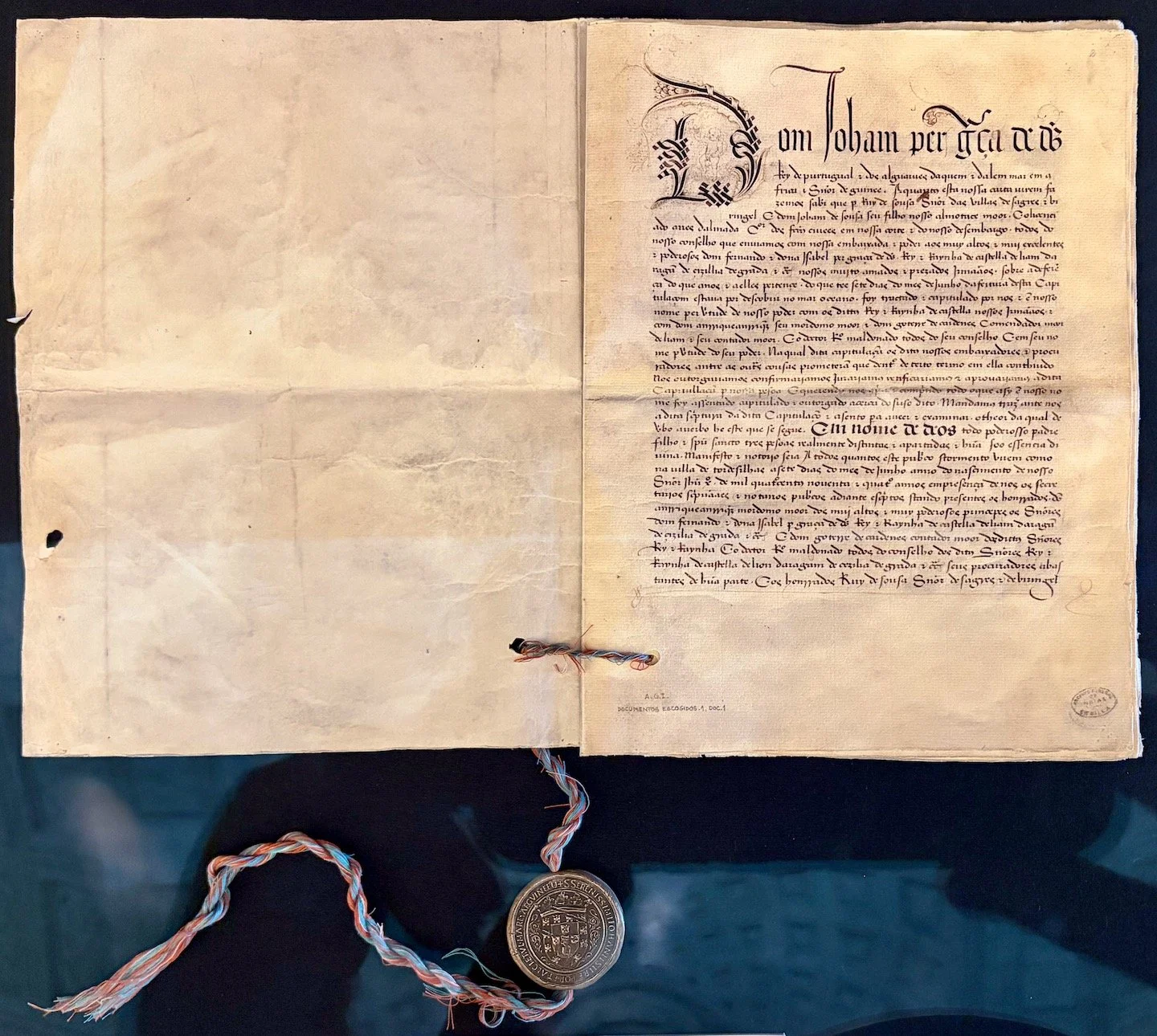
The Treaty of Tordesillas, 1494. Archivo de Indias, Sevilla. Photo: Hubert Murray
The treaty was an agreement between the Reyes Católicos, dividing the new lands discovered by Europeans outside Europe between the Kingdom of Portugal (Ferdinand) and the Castilian Crown (Isabella). More or less a post-nuptial agreement, it was promulgated by one pope (Alexander VI) and ratified by another (Julius II). 1494, if you think about it, was only two years after Christopher Columbus ‘discovered’ America, so the great powers of the time were playing a quick catchup with events as they were unfolding. France and Britain, the only other major contenders, were left out of the deal.
So what was the deal and why was it so consequential? The agreement was based on a line drawn more or less north-south, halfway between Cape Verde on the west coast of Africa and Cuba and Hispaniola in what we now know as the Caribbean. To the east of the line, the new lands were to belong to Portugal; and to the west, to Spain. The east coast of Brazil overlapped the line so it was agreed that the Brazilian coastline and whatever lay behind it, should go to Portugal. Various ensuing treaties tinkered with the geometry and as European exploration continued, so the other side of the world - those bits that has not already been conquered by France, Britain and the Netherlands - was apportioned between the Catholic Monarchs.
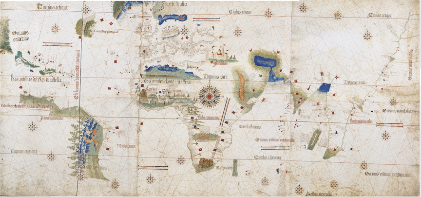
Cantino planisphere depicting the meridian, generally considered to represent the Portuguese Casa da Índia’s official Padrão Real c. 1502. Wikimedia
Tordesillas itself was a minor regional hub in the Kingdom of Castile with an estimated population at the time of 2,000 to 3,000 residents. It is 180 kilometers northwest of Madrid, 90 kilometers northeast of Salamanca (estimated to have between 15- and 25,000 residents at that time). Why, one might ask, was this treaty signed in such a small town on a hot June day in an unremarkable landscape, some days’ ride from the centers of temporal and intellectual power at the time, difficult and time-consuming to get to? For those very reasons it seems — a meeting place of moribund neutrality. Would kings and queens and royalty really have gone out of their way to sign this document in such a place? “They sent their lawyers” a Spanish friend suggests.
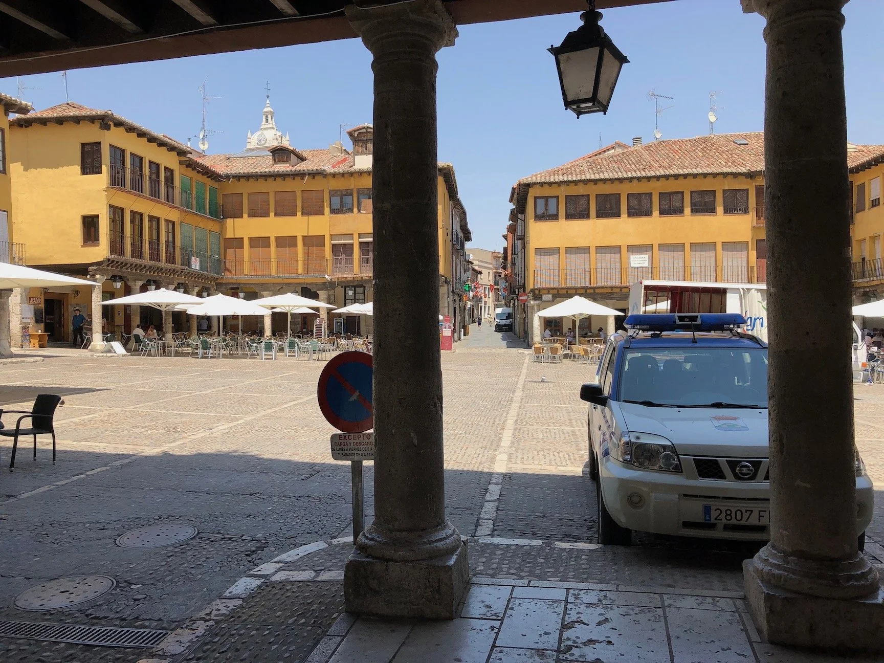
Plaza Mayor de Tordesillas, 2019. Photo: Hubert Murray
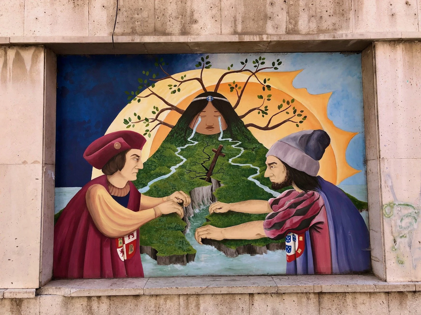
The Treaty commemorated in murals, Tordesillas 2019. Photos: Hubert Murray
The consequences of the treaty are that Cape Verde, Brazil, Angola, Mozambique, Goa and East Timor amongst others are primarily Lusophone (some speaking Portuguese as a second language and language of trade); and that all the other countries of south and central America and some in the Caribbean are Spanish-speaking.
As a result of this division, trade and immigration in the 21st century and the attendant savage inequalities of global power still largely follow the lines of communication established in the late 15th and early 16th centuries by those colonial powers. The broker, the Catholic Church, is common to all those territories, Spanish and Portuguese, to which the French colonies were added. Protestant Britain and its colonies remained outside that spiritual realm.
At what other times and in what other circumstances were lines drawn on a map with such consequence? France and Britain carving up their spheres of influence in Europe and the New World are famously encapsulated in Gillray’s cartoon depicting the skinny prime minster Pitt sitting at a table with the short and chubby Napoleon sticking their knives into a plum pudding globe, Napoleon taking great slices of Europe, Pitt the north Atlantic and America. Haiti, Quebec and Louisiana still bear cultural traces of the imperfect shareout and English, not French, being the lingua franca of the European Union reflects later squabbles over portions.
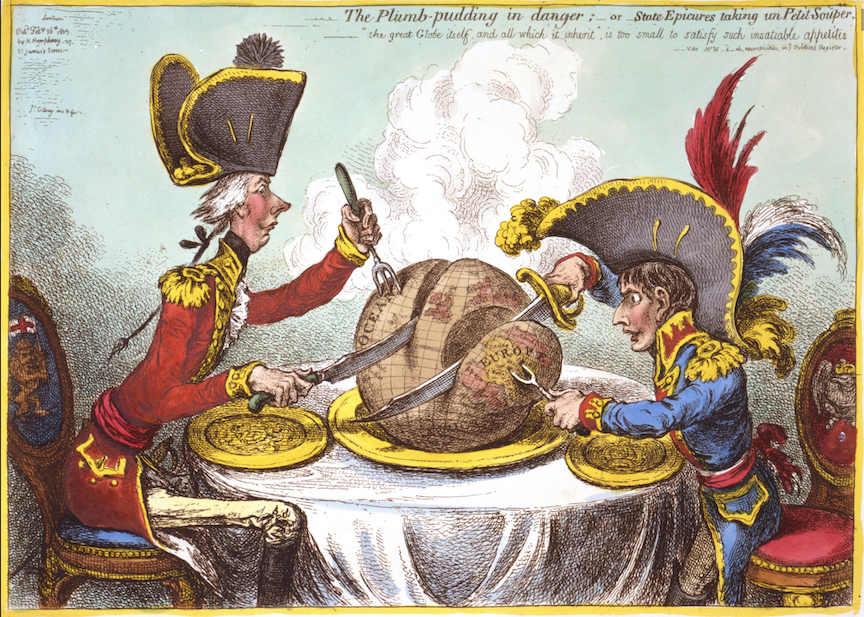
The Plumb-pudding in danger, or, State epicures taking un petit souper is a famous 1805 political cartoon by English artist James Gillray that shows British Prime Minister William Pitt and French Emperor Napoleon carving up the world as a plum pudding. Wikipedia
In British colonial history, the line of division between Tanganyika (German) and Kenya (British) in 1886 notoriously tore through the historic grazing lands of the Maasai, a grievance that lasts to this day between the two independent states.
The Sykes-Picot agreement [ii] made in secret in 1916 between France, Britain and Tsarist Russia was designed as a division of the spoils after the defeat of the Ottoman Empire. Modern day Lebanon, Syria, Iraq and Iran had their national lines determined in London and Paris (the Russians having withdrawn from the imperialist war after the October Revolution). The Kurds were cut in three.
The boundaries of Gaza today are determined by their occupiers on a map where the drawing in felt pen of a line so thick that at scale it represents tens and in some cases hundreds of meters of ambiguity and the difference between life and death for the occupied. This lethal ambiguity is exacerbated by the yellow felt pen that redraws the line almost daily [iii].
President Trump in his recently announced foreign policy has determined the western hemisphere to be the sphere of influence of the United States [iv]. This policy is in direct descent from the Monroe Doctrine and the Manifest Destiny doctrine of the early nineteenth century through to the aggressive interventionism of Ronald Reagan in El Salvador, Guatemala and Nicaragua in the 1980’s. Venezuela is the latest legatee of this imperial dominance.
Lines on a map are a graphic distillation of political power. The distances between princes and peasants are not only geographic, they are vectors of power drawn on a representation of land and resources [v]. The distances from Seville to Havana and Mexico City; from London and Paris to Beirut, Damascus and Tehran; and from Washington and Tel Aviv to Ramallah and Gaza City are reduced to the cries of the wounded, the starving and dispossessed and to the wails of those who mourn their dead and are cursed to continue living.
Behind the scratching of a quill pen on parchment and the nine kilometers of inscrutable boxed archives in these exquisitely vaulted halls there are stories of rape and massacre, conquest and expropriation and the vast accumulation of riches manifested in the fine buildings and great art we see around us, sacred and profane. To the visitor, the only indicator of such suffering is in the blood red marble of the floors and staircase.
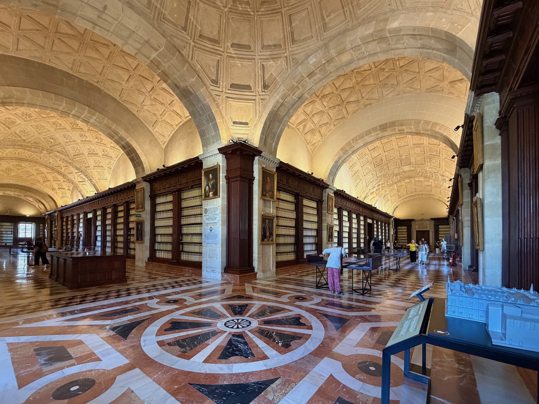
Main archival room, Archivo de Indias, Sevilla. Photo: Hubert Murray
What I saw last week in the Archivo de Indias in Sevilla was a facsimile. The consequences of the line, drawn in the small town of Tordesillas, remain very real [vi].
First appeared on Medium 14 September 2026; revised 15 September 2026, footnote [v].
[i] https://en.wikipedia.org/wiki/Treaty_of_Tordesillas
[ii] https://en.wikipedia.org/wiki/Sykes–Picot_Agreement
[iii] Eyal Weizman, Ungrounding, the Architecture of Genocide, London 2026
https://www.britannica.com/topic/History-of-US-Intervention-in-Latin-America-and-the-Caribbean
Carolyn Forché: What you have heard is true (2019)
https://english.elpais.com/usa/2026-08-14/trump-extends-his-military-tentacles-in-latin-america.html
[v] Having written this piece my attention was drawn by a reader to the excellent article by Linda Quiquivix on the same subject published in August 2026 in Places Journal. https://placesjournal.org/article/cutting-the-earth-in-half-mexico-guatemala/. See also Linda Quiquivix: Palestine 1492: A Report Back. Wild Ox Books, 2024.
[vi] The most accessible work in Spanish and English is Eduardo Galeano’s Las venas abiertas de America Latina (1971); The Open Veins of Latin America(1973,1997).